CHS SDIR PAC 201F Strait Juan de Fuca & Strait of Georgia 2026/01 (French)
CHS Sailing Direction PAC 201 Juan De Fuca Strait And Strait Of Georgia
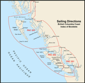
The Sailing Directions booklets are an indispensable companion to nautical charts. They are a great tool for planning and assisting in navigation because they provide information that cannot be shown on a chart.
Author: CHS
Date: 2026
Format: Comb Bound Booklet
Number of Pages: 357
CHAPTER 1 Juan de Fuca Strait — Pachena Point to Royal Roads
General _________________________________________________________ 1-1
Juan de Fuca Strait and Approaches _________________________________ 1-1
Juan de Fuca Strait — South Approach ______________________________ 1-5
Juan de Fuca Strait — South Side ___________________________________ 1-5
Juan de Fuca Strait — North Approach ______________________________ 1-8
Juan de Fuca Strait — North Side ___________________________________ 1-9
Sooke Harbour and Approach _____________________________________ 1-10
Becher Bay and Approach_________________________________________ 1-14
Race Rocks _____________________________________________________ 1-14
Race Rocks to Royal Roads________________________________________ 1-15
CHAPTER 2 Esquimalt Harbour and Victoria Harbour
General _________________________________________________________ 2-1
Esquimalt Harbour and Approach___________________________________ 2-1
Victoria Harbour and Approach_____________________________________ 2-5
Victoria Harbour to Discovery Island _______________________________ 2-13
CHAPTER 3 Brotchie Ledge to Vancouver — Haro Strait, Boundary Pass and
SE Strait of Georgia
General _________________________________________________________ 3-1
Haro Strait and Boundary Pass _____________________________________ 3-1
Haro Strait — South Approach _____________________________________ 3-5
Haro Strait — South End __________________________________________ 3-5
Haro Strait — North End __________________________________________ 3-5
Boundary Pass — North Side _______________________________________ 3-6
Boundary Pass — South Side _______________________________________ 3-7
Boundary Pass — East End ________________________________________ 3-7
Strait of Georgia — SE Part ________________________________________ 3-7
Boundary Bay — Semiahmoo Bay __________________________________ 3-10
Point Roberts to Point Grey _______________________________________ 3-11
CHAPTER 4 Fraser River, Pitt River and Lake, Harrison River and Lake
General _________________________________________________________ 4-1
Fraser River Main Channel ________________________________________ 4-3
Sand Heads to Steveston ___________________________________________ 4-5
Steveston to Tilbury Island _________________________________________ 4-5
Annacis Island to New Westminster__________________________________ 4-6
New Westminster — Fraser Port ____________________________________ 4-9
Fraser River Secondary Channels ___________________________________ 4-9
Fraser River — North Arm______________________________________ 4-9
Fraser River — Middle Arm____________________________________ 4-13
Canoe Passage___________________________________________________ 4-13
Sea Reach and Ladner Reach ______________________________________ 4-15
Annacis Channel_________________________________________________ 4-15
New Westminster to Douglas Island_________________________________ 4-17
Pitt River_______________________________________________________ 4-18
Pitt Lake _______________________________________________________ 4-21
Douglas Island to Cresent Island ___________________________________ 4-22
Cresent Island to Harrison River ___________________________________ 4-24